Antietam Creek in Maryland
Trip information
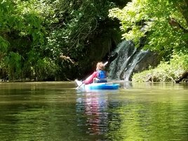
Traveled from Devils Backbone Park to just below Burnside Bridge on May 8th 2017. About 8 miles. Took 3 hours. Water levels were 3.25 feet.
Note: you can go further than this ... all the way out to the Potamac but that would be a 12 mile trip. Note: this is an interesting float with some rapids where the stone barrier is all the way across the creek. You can do this trip at 2.6 feet but you will scrape a lot and likely need to get out more. At 3 feet and above there is no scraping. Be aware that though we did not tip at 3.25 feet we did take on some water at one point. Also note that there is a water drop before the takeout below Burnside Bridge
References ...
Water levels Link
Put in at Devils Backbone Park Link
Take out below Burnside Bridge Link
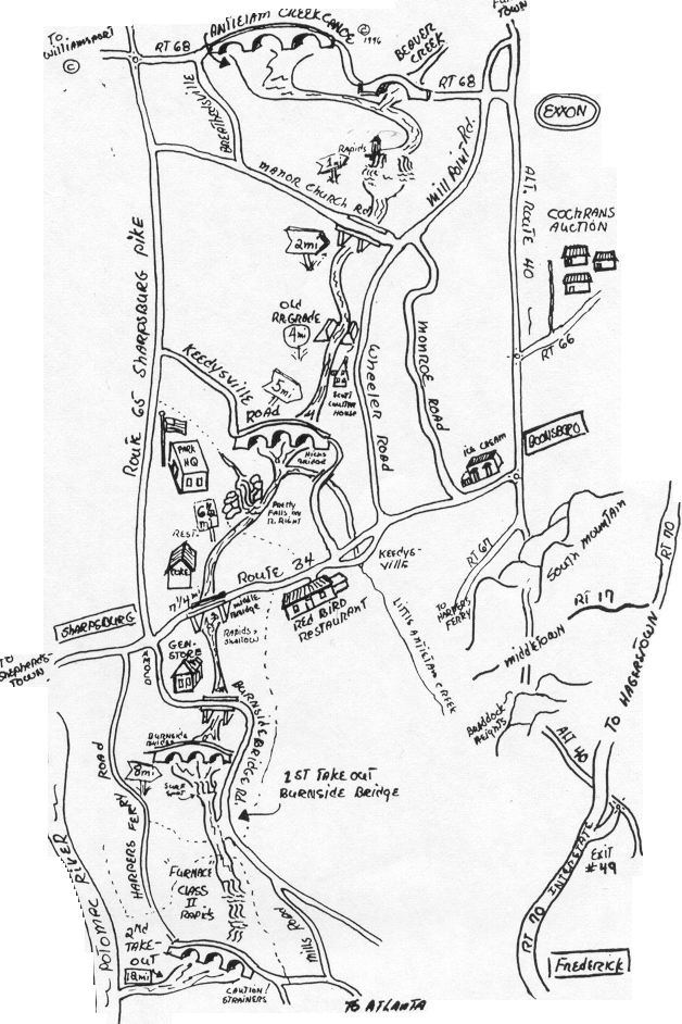
Map of water trail courtesy of Antietam Canoe ..
Times:(all times listed are from beginning of trip)
40 minutes to first bridge
1 hour 36 minutes to second bridge
2 hours 12 minutes to 3rd bridge
2 hours 30 minutes to 4th bridge
Traveled from Devils Backbone Park to just below Burnside Bridge on May 8th 2017. About 8 miles. Took 3 hours. Water levels were 3.25 feet.
Note: you can go further than this ... all the way out to the Potamac but that would be a 12 mile trip. Note: this is an interesting float with some rapids where the stone barrier is all the way across the creek. You can do this trip at 2.6 feet but you will scrape a lot and likely need to get out more. At 3 feet and above there is no scraping. Be aware that though we did not tip at 3.25 feet we did take on some water at one point. Also note that there is a water drop before the takeout below Burnside Bridge
References ...
Water levels Link
Put in at Devils Backbone Park Link
Take out below Burnside Bridge Link
Map of water trail courtesy of Antietam Canoe ..
Times:(all times listed are from beginning of trip)
40 minutes to first bridge
1 hour 36 minutes to second bridge
2 hours 12 minutes to 3rd bridge
2 hours 30 minutes to 4th bridge